blah blah blah
Black Cap
Length: 2.5 miles out-and-back with loopDifficulty (click for info): Easy
Elevation Gain: 660 ft (+10 feet on return)
Rating (click for info): 7/10
Elevation: 2369'
Prominence: 950'
Driving Directions:
Trailhead and parking area are on Hurricane Mountain Road in Conway, NH. (Seasonal road - check status on TrailsNH to verify gate status). Hurricane Mountain Road begins off the east side of Rt. 16, 0.1 miles south of the southern junction with Rt. 16A. The trailhead is 3.7 miles down the road, on the right side in a large clearing at the height of land. In a little over 2 miles, the road passes through a seasonal gate and rapidly becomes one of the steepest public roads in the state. It is paved the whole way to the top, but you will need to exercise caution while navigating sharp turns on at equally sharp grade. Click here for a Google map.
About the Hike:
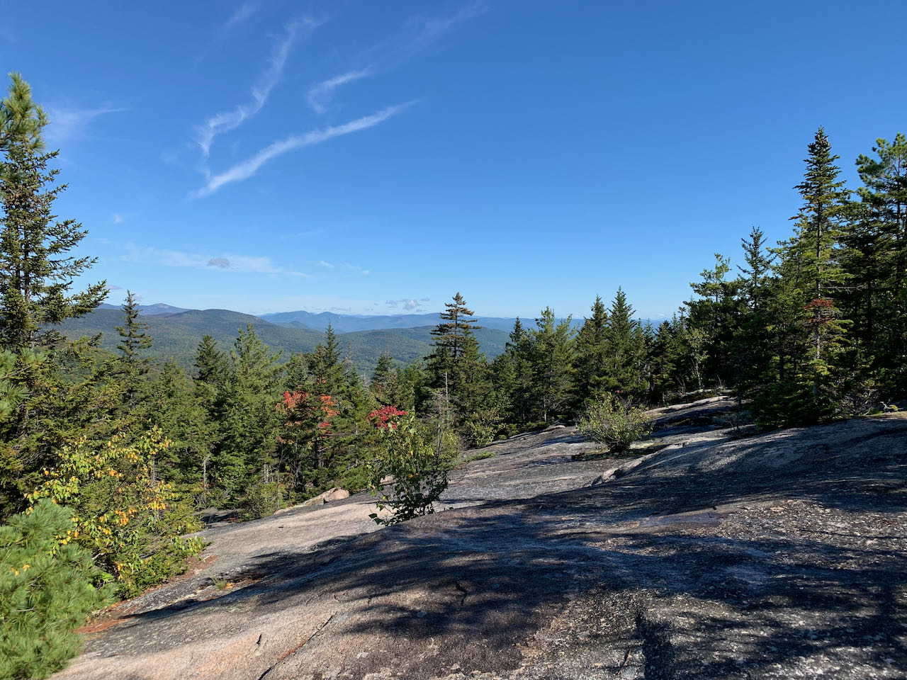
Highest of the Green Hills in Conway is Black Cap. This low, verdant region of miniature mountains is enclosed within The Nature Conservancy's Green Hills Preserve, which aims to protect, among other things, the red pine-rocky ridge environment found on the notable summits of the hills. It also opens up the range with a well-cared for trail network, which webs over the whole area and accesses Black Cap, along with the top of the Cranmore Ski Area and Middle and Peaked Mountains. Black Cap is the archetype "little mountain with big views" - though in the modest 2000-2500 foot camp, the mountain's extensive open ledges offer panoramic views over the Conway valley to the imposing Moat Mountain ridge and higher summits beyond.
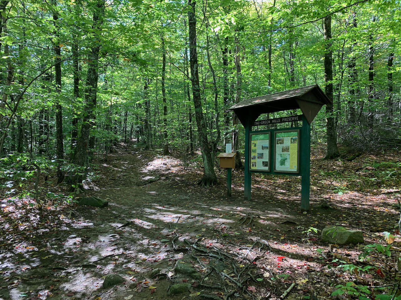
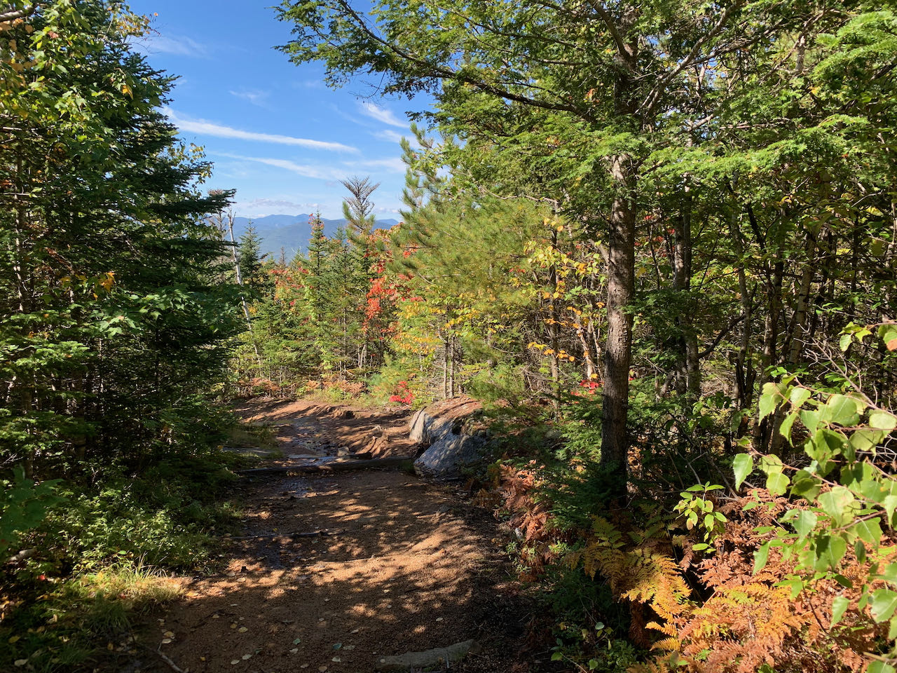
After surviving the unsettlingly steep drive up Hurricane Mountain Road, the hike starts from the Nature Conservancy's large parking lot in the flat mountain pass between Black Cap and Hurricane Mountain, where recent logging activity has pervaded the area. Follow the wide and level Black Cap Trail beyond trail signs into the woods. After dipping slightly, the trail ramps up its ascent of the mountain over more rocks and roots. Never does the grade become anything that could be described as steep until it breaks out of the forest. In just over 0.4 miles, the trail passes an information kiosk with a trail register and history of the property. The trail continues uphill over increasing amounts of bedrock, and passes a trail junction with the Cranmore Trail, which opens up the option for a lengthy (1.2 miles each way) side trip to the top of the ski area of the same name. In 0.1 miles further, a trail junction with Black Cap Connector is reached. Here is where you will split off to make a scenic loop over the summit. Take the main trail first, staying left. The trail climbs more steeply over rockier terrain, passing through one trench-like section which shows signs of overuse. In just over a tenth of a mile, the trail pops out onto the open ledges. Follow with attention the red blazes painted on the rock to mark the trail as you work your way up occasionally sharp-angled ledge.
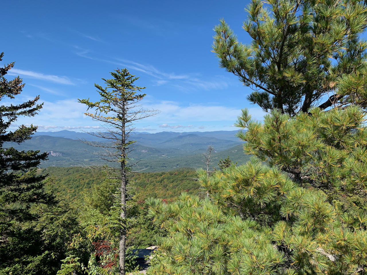
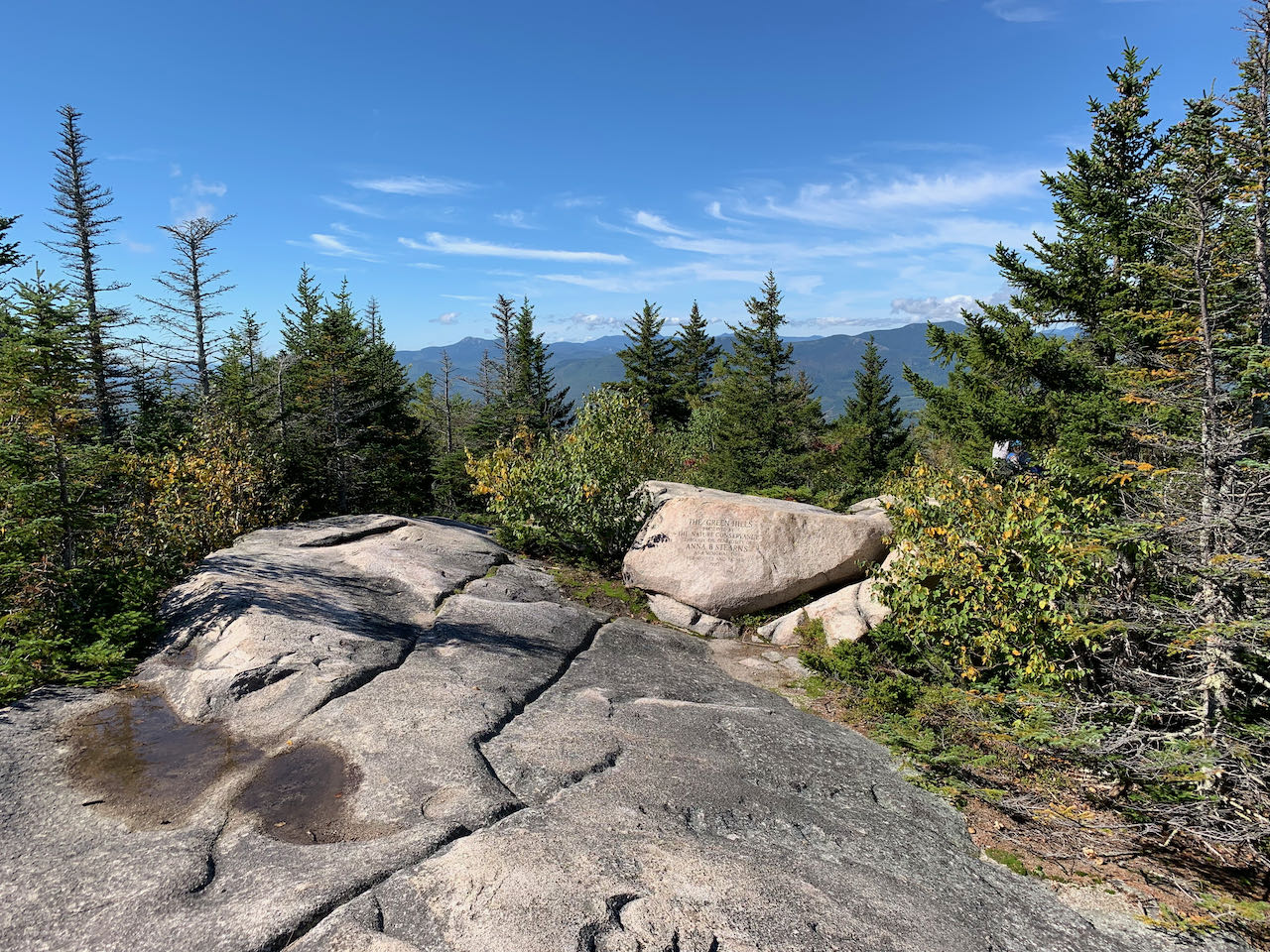
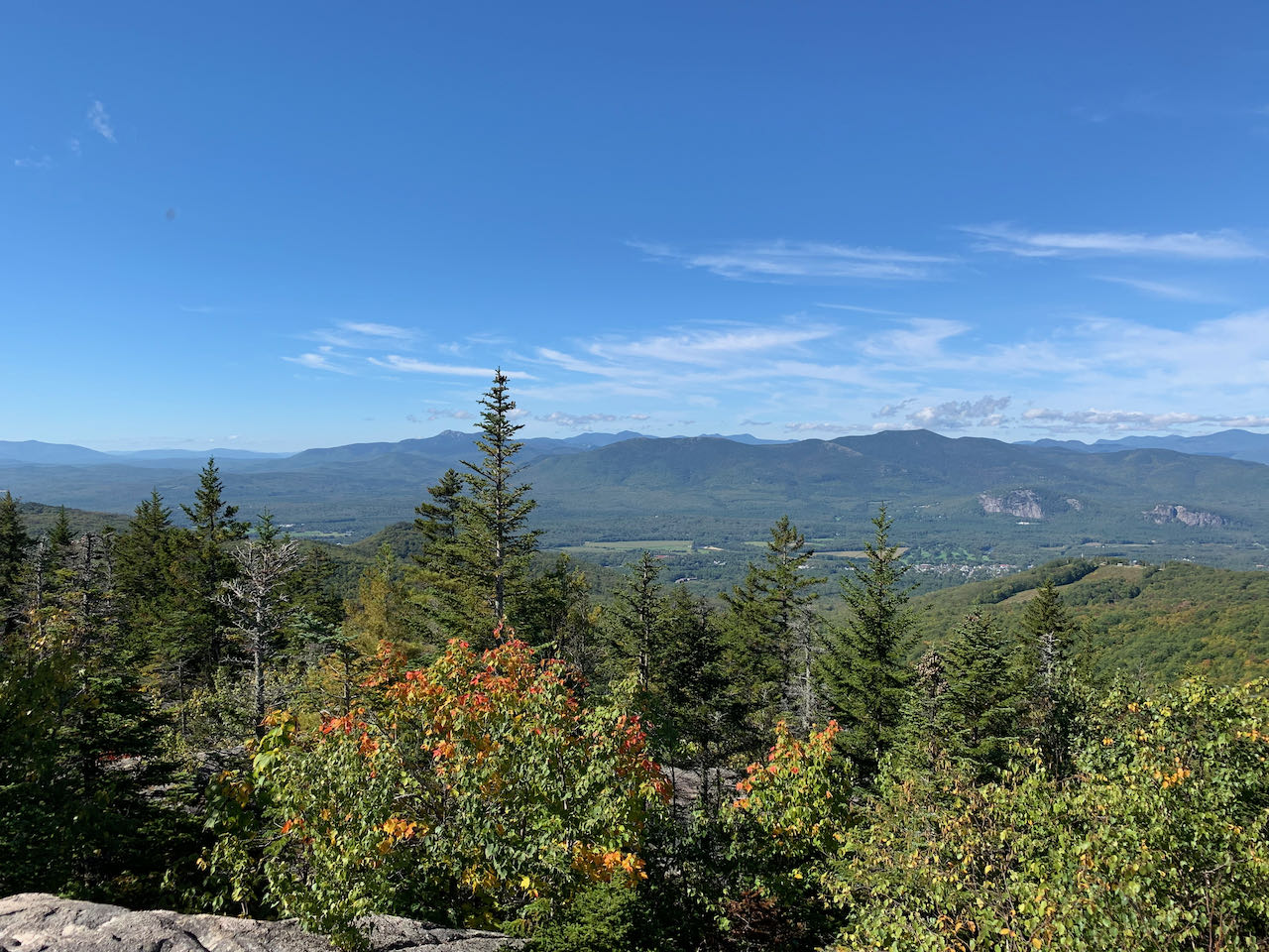
Views open up almost immediately over the trees to the north. The closest mountain to you is Kearsarge North. Peeking out from behind its right slope, South Baldface can be seen. Further over is a fine view in the direction of the Royces and Evans Notch. To the left of Kearsarge North is a great view of Mt. Washington and the Southern Presidential ridgeline. A jumble of the central Whites appears over the treetops further over. Continue climbing out in the open and through slots in the trees up to where a short loop leads out to the right to a particularly open spot with a fantastic view of the Moat Range. The twin cliffs of White Horse and Cathedral Ledges loom over the center of North Conway. The top of Cranmore is also visible nearby. The open catwalk of Red Ridge is prominent rising up to the Moats. To the left of South Moat, some of the peaks in the Sandwich Range are seen, including furthest over, the rocky spire of Mt. Chocorua. About half of the Ossipee Range can be seen coming out from behind the trees to the left. This is probably the best spot throughout the trail, so budget time to enjoy the view here! Just a bit further up over the rolling stone and you reach the summit, where views are much lesser. An engraved boulder sits off to the left with a commemoration of the donors of the preserve. Continue straight down a set of stairs carved directly into the rock and start down the Black Cap Spur Trail. The path transitions into a wide gravel walkway as it meanders down the other side of the summit cone. In about 0.2 miles, bear right and merge onto the Black Cap Connector. The path descends gently for 0.4 miles back around to meet the Black Cap Trail.
Printable directions page